 |
| The way as it heads through the pines |
 |
| Typical road of the day |

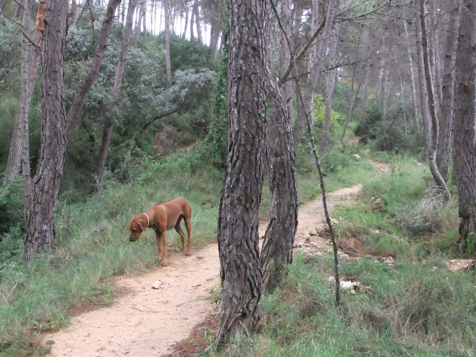
 The ayuntamiento was open at 08.00 so I got my sello easily and set off along the well marked, scallop shelled route. Michael came along with Ndzilo, joining us for the first 40 minutes before turning back. For those walking this section - you will be delighted with the well marked, easy to find route. Shells and arrows are clear and obvious a long way ahead of the walker. The only moment of doubt was as we left the town and headed up a main road (not busy) and rounded a bend heading up hill. The arrows were a little sparse here - but don't panic if you, are on the right route and the way will become obvious. Once we had turned off the road, we were on an easy to follow dirt road which wound its way through the orchards and agricultural land toward a pine forest. From there it took a gentle incline up the slopes of the side of the valley.
 To be honest, there is not so much to write about today's journey - the photographs really speak for themselves! We were in the country most of the time and there were only the two towns. The time flew past, before we knew it we were with Michael at the "dog swap point". We passed many old farms, buildings that no doubt were there during the Middle Ages when pilgrims passed this way. One had the most stunning archways and chapel attached. I could imagine peregrinos stopping off to ask for a place to rest for the night. When we stopped for our breakfast at 10.10, the guidebook told us that "Monserrat" was the 9km point... and when I looked up, there was the sign! We were only about 20 minutes from our meeting point and which we made by 11.00. The road for the support vehicle followed us in parallel for much of the way, although some distance off. At one time it coincided and as Akina and I turned right, we saw the car pass below us on the road, also passing through beautiful scenery. The orchards today were mostly almonds although there were the usual olives and other crops.
Some of the old houses we passed were inhabited but looked as though they were stopped in time. Totally closed up, a little smoke from the chimneys, animals making noises from inside and the smell of urine wafting in the air from the barns. Washing on the lines giving away that there were inhabitants within, but otherwise, the places looked like ghost houses. There were many other walking and cycling routes that we passed too, the options were endless and it is a great place to go hiking, dog walking or cycle touring.


As you can see, the way was well marked and the guidebook descriptions perfect. Very clear and easy to follow for the most part.
Here are some of the scenes from the day - the stunning properties and clear views into the distance. Just along from here, past the sign of Monserrat and a little beyond the houses pictured below, is "Bastida de les Alcusses". The website listed below gives us the following details about it:
Bastida de les Alcusses is located 8 kilometers away from the population in the municipality of Moixent. It is the largest Iberian settlement of Valencia, declared Cultural Interest Heritage on June 3, 1931. Located at 714 meters you can see the beautiful overview of the wine fields, pine forests, olive groves and small farms.
La Bastida shows an urban complex, with large houses grouped in blocks and ready to either side of the main street that runs through the village. Visitors can relive the atmosphere of a 2,300 years old rural family home with the reconstruction of an Iberian house. In addition, the site has a free guide service and information panels in order to invite you to know more about the Iberian culture.


Check out: http://www.terresalforins.com/en/la-historia-y-cultura/

A strategic location places Terres dels Alforins in a historic trade route and communications that linked the Levant and the Castilian plateau. The Vía Heracla of the Iberians and Carthaginians, or the Via Augusta of the Romans, has been seen over the centuries as they passed the different cultures that have inhabited this territory and left its mark.
The past full of greatness is displayed at the Museum of Historic and Artistic of Moixent and can be seen through the different customs and cultural traditions of a people, in the Historical Museum Enologic of Font de la Figuera.
 Traces that take us back to the Paleolithic and Bronze Age, some are more relevant, such as the Iberian settlement of Valencia: the Bastida de Les Alcusses, was declared Cultural Interest heritage. Located a few miles of Moixent, it seems to relive the atmosphere of a rural family home of 2,300 years ago.
Another peculiarity of Fontanars dels Alforins heritage are more than thirty, Hornos de Cal (lime kilns). Integrated into the landscape and scattered throughout the city are hard to find, some are even under the vegetation, but in the recreational area Les Piles you can visit one of them, easily accessible and still in good architecture conditions.
 |
| Akina with the Robertson Mala |
The altarpiece of the Nativity Parish Church of Our Lady, La Font de la Figuera, is the work of Juan de Juanes, around 1547-1549.
It is considered a fundamental work of Renaissance Valencia and over time it has experienced numerous ups and downs, although the most serious took place on April 12, 1936, when the church was looted and burnt, it missed the Renaissance architecture but some paintings suffered considerable damage.
 |
| The altarpiece painted by Juan de Juanes |
 |
| The wells along the route have these cute conical rooftops |

 |
| Kaishi after the "dog swap" |

 |
| Mud, not diamonds on the soles of my shoes! |
 |
| Beautiful scenery and orchards on the clay tracks toward La Font de la Figuera |
  |
| The well marked and clear, new signs all around La Font de la Figuera, including for the Cami de Santiago |
The way was easy to follow into La Font de la Figuera and there are new signs, nicely erected for various walks. One is shown above. There is also a new road construction going on between the A31 and A35 and this has changed some of the paths to the west of La Font. The way, once out of the Plaza Mayor, is harder to find, I think because of the new construction. There is new paving and so there are no arrows (that I could find) along the route. Once I had collected my sello from the ayuntamiento at the far end of the Plaza Mayor and had a nice cold end of walk beer in the "Bar Colon" on the square, Michael and I took a drive out of the town in order to make sure we could locate the next part of the route quickly next time. With all the new construction, it would be easy to spend time hunting around. There is one yellow arrow on some armco on the side of the road leading out of the town and this is correct.
Walkers should continue up the hill, with the new road on their right. It is huge and there is a temporary bridge crossing it which takes you onto the Camino. Don't think you are wrong, it really is a bit of a distance (maybe 2.5km) before you pick up a sign, similar to the one shown above. I will make sure I photograph the way clearly next time. Of course, as this blog gets older, the information might not be so accurate - but for now, in November 2012, the information is correct. The guide does not mention the new road or any of this at all - it was new in earlier 2011 - but this work post dates the printing of the guide. I am sure that arrows will appear again in time and the local authority signs clearly mark the way. I am a little concerned about a few points on the next route as checking the road on Google maps and comparing them to the guide, we may struggle toward the 17km point. It seems as though we might have to cross this new, very deep cutting of the road and that it passes right through the Camino. I will know for sure on the next section and will photograph developments and changes if there are any. Also, once the road is finished, although it won't look like my photos, it will still follow the same route, so hopefully this information will help Camino walkers following behind me.

 To return for the moment to the end of today's walk, for anyone arriving around lunchtime in La Font de la Figuera, do take the opportunity for some tapas and beer in "Bar Colon to the right as you walk up the Plaza Mayor toward the ayuntamiento. This is a lovely little bar and was most welcoming at the end of the journey. Also, the ayuntamiento (who have a special Camino stamp - see below) asked me as soon as I went in with my passport whether I would like accommodation for the night. I chatted to a Spanish lady there but two other ladies in the office had good English, for those walking the route who maybe have very basic Spanish or not much at all. They were all most friendly and welcoming and were happy to chat. Yet again I have been impressed with the friendliness of the local ayuntamientos and officials - they are such a different experiences from the ones I have had in both the UK and South Africa, where one has to spend days plucking up courage to face "officialdom"! They could learn much from the Spanish in this respect.
As you enter the Plaza Mayor from the route, you will find yourself facing Juan to Joanes (his name seems to be spelt slightly differently everywhere I look but this spelling is on the statue!) He was born here and is a painter of some note (see above). Many of his works can be seen on Google if you search for his name and "pictures".
 |
| The stamp shows the "fig tree" from which the town takes it's name (the fountain of the fig) The public well where the fig used to grow is now called the "Pozanco" |
We ended today's walk of 17.6km by the statue, bringing the total to 114.6 - just over 1/12 of the way! Incredible! La Font de la Figuera is also significantly, the last town in the Valencian Province! Next time we will cross the border into Albacete!
No comments:
Post a Comment